HARMONY DESIGN & ENGINEERING
  • Home
  • About Us
    • Our Team
    • Core Attributes
    • Blog
    • Press and News
    • Community Involvement
  • Services
    • Civil Engineering
    • Land Surveying
    • Water Resources
    • Landscape Architecture
    • Planning and Community Outreach
  • Project Gallery
    • Civil Engineering Projects
    • Water Resource Projects
    • Landscape Architecture Projects
    • Planning and Outreach Projects
  • Employment
  • Contact
    • Helpful Links

A Guide to Subdivisions in Teton County, Idaho

7/5/2023

0 Comments

 
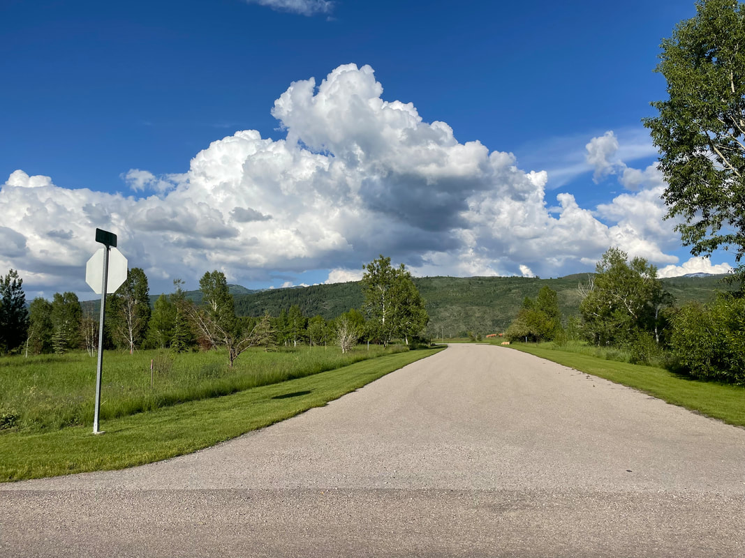
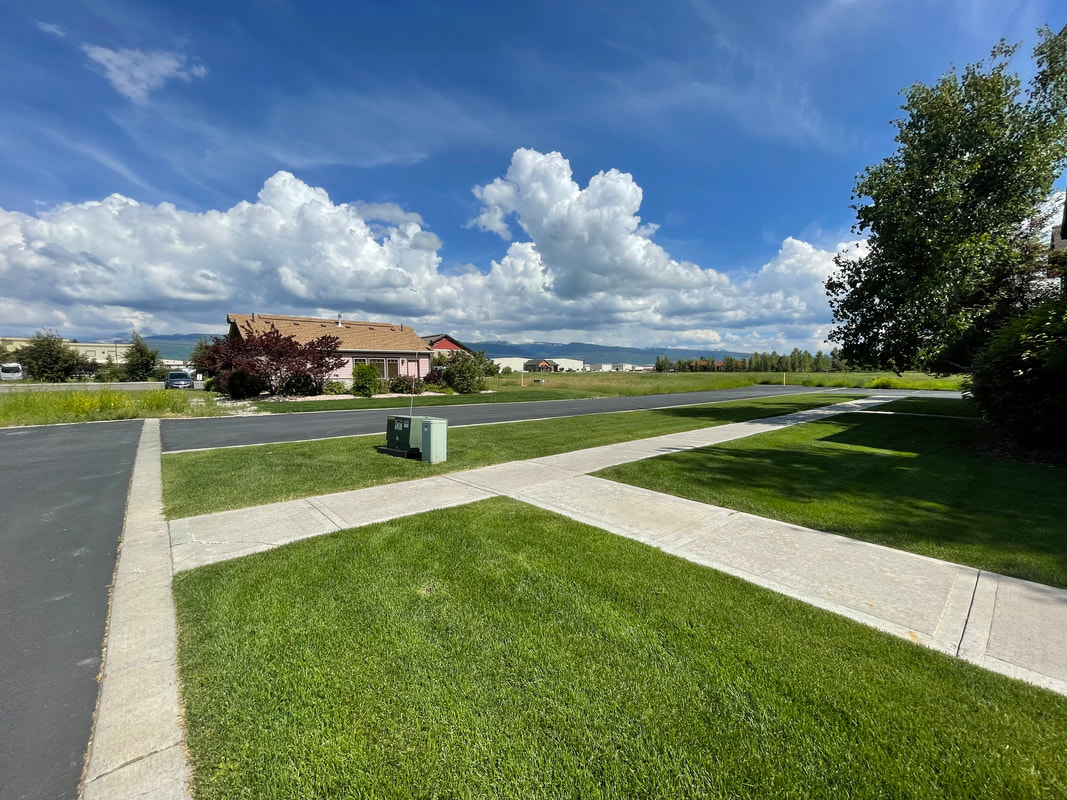
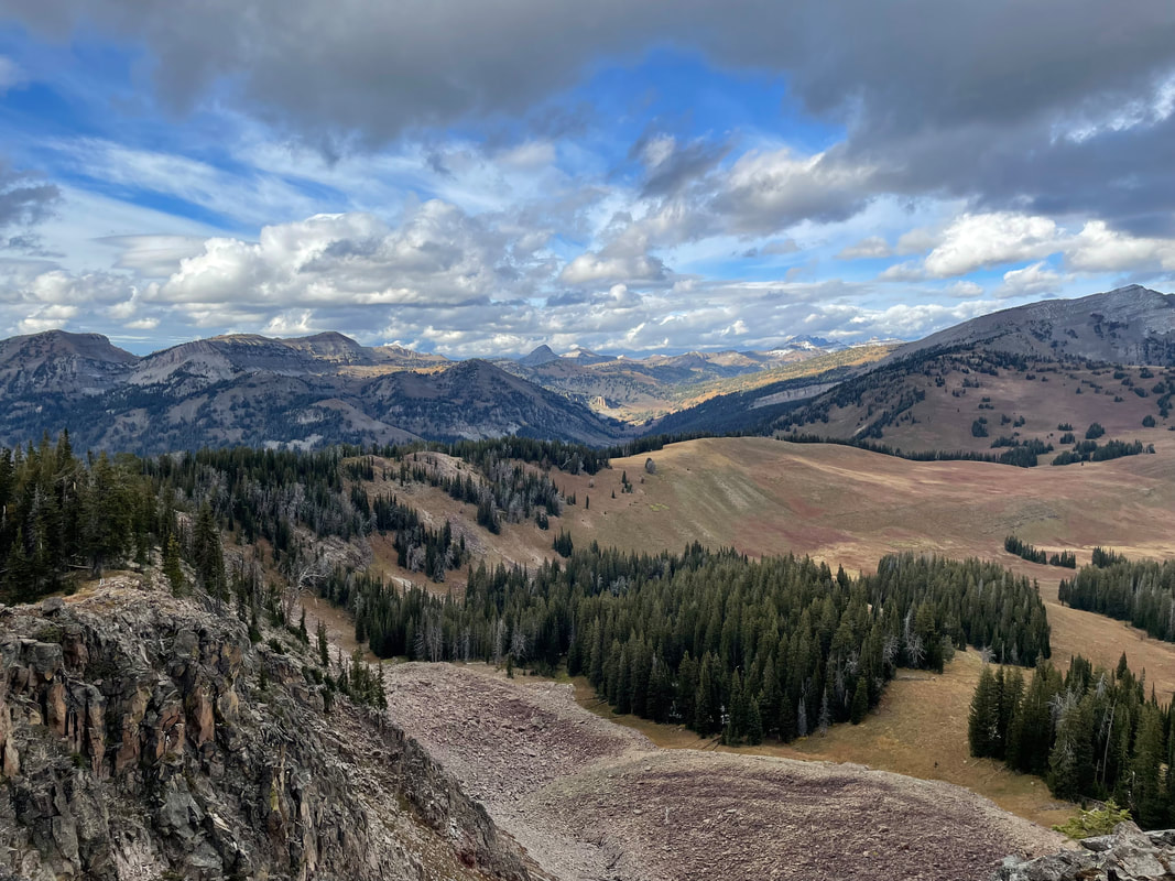
Teton County, Idaho, is renowned for its breathtaking landscapes, vibrant communities, and a plethora of outdoor activities. We believe that if subdivisions are planned carefully, we can help preserve valuable natural resources while also providing space for homes. This guide can help you navigate the entitlement process. Let Harmony help you explore what's possible and define how to get there. ​
Picture
Harmony Design & Engineering has been working locally to improve our community, focusing on the interface between the natural and built environments for almost twenty years. We have the expertise to efficiently navigate the requirements and procedures for subdivisions, and have seen dozens of high quality developments from pre-application conference to certificate of completion. We're constantly rewarded by seeing the impacts of sustainable, accessible, and responsible development in our physical landscape.

If you're curious about the potential of a piece of property, we can help determine what's possible, and the procedures to achieve your vision.

Subdividing can unlock the potential of large land tracts, providing needed housing, amenities, and open space preservation.

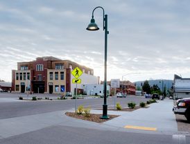
The County's Land Development Code defines how a property owner divides land, what uses are allowed, and the administrative procedures for approving development entitlements. When considering a subdivision, the Code is the first place to look.
​

First Steps: Familiarity
Get in touch with us to discuss what's possible within the requirements of the Land Development Code. Each parcel is subject to set backs, dimensional requirements, residential density standards, and use standards, differentiated by the assigned zone.
​

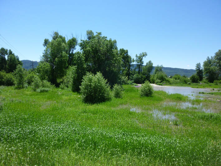
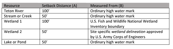
Parcels also have a designation in the Comprehensive Plan, which will guide future development. Approval of subdivisions is dependent on whether the plan conforms to the guidance of this document. Various regulations defined by Wetlands and Waterway Protection, Wildlife Habitat, Hillsides, and the Driggs Airport may affect what's possible on your parcel as well.

Making a feasible subdivision plan requires being familiar with all applicable regulations.
Picture

General Procedure
The timeframe, cost, and work involved can vary greatly depending on the type of subdivision you are undertaking. Most subdivisions will be either a lot split, short plat, or full plat. Regardless of the location and scale of your subdivision, it will follow a common procedure from concept plan to recording and sale of the lots. The basic steps are as follows:
Pre-Application Conference
Meet with the Planning Staff to discuss your ideas and determine requirements
Concept Plan
A rough draft of the subdivision, showing number of lots, proposed utilities, and road layout
Additional Studies
Natural Resource Analysis for wildlife habitat, Nutrient/Pathogen studies for septic permitting, Wetlands Delineation, among other studies, may be required and should be identified during the Pre-App Conference
Survey, Design, and Engineering
Creation of the plat, which legally defines lot lines, as well as engineer's improvement plans for roads, water and sewer, and other infrastructure
Application
Submit all the required application materials, including draft legal documents, plat or survey, improvements plans, and additional studies
Review
Planning staff will review your application and if required, conduct one or two public hearings at the Planning & Zoning Commission and City Council or Board of County Commissioners. This is the community's opportunity to voice their opinion on your project.
Approval
Whether the application is administratively reviewed or voted on by elected officials, the decision making body may require changes or conditions to approve the subdivision, and might require additional public hearings.
Improvements
Once approved, you must comply with special conditions and can install public improvements such as roads, and sanitary services. You may also build vertical construction at this time.
Recording
​
When construction is complete, improvements are inspected and accepted by the engineers. The final documents are recorded and lots can be sold.
Different Types of Subdivisions

There are a few ways to divide land, depending on what type of parcel you have and what you want to end up with.

Make Like a Banana
The simplest route to dividing land is a lot split. Within the incorporated boundaries of Victor and Driggs, land owners may enact a lot split that results in two parcels. On unincorporated County parcels, owners may utilize an agricultural land division, which may result in two parcels at least 140 or 80 acres, depending on the zoning.
To apply for a Lot Split, you will need a survey of the parcels with the proposed boundary lines, as well as draft deeds for the resulting parcels to be recorded upon approval. Lot splits are administratively reviewed and usually don't require a public meeting or public hearing. Lot splits usually take 1 to 3 months to complete.
Eligibility for a Lot Split
Driggs:
Lot must have been recorded prior to December 1, 1992
Each resulting lot must meet setbacks, dimensional requirements, and have existing access to a public road
No new public right of way, new public streets, or extension of utilities
Victor:
Lot must have been recorded prior to January 1, 1990
Each resulting lot must meet setback and dimensional requirements, and have existing access to a public road
No new public right of way, new public streets, or extension of utilities
Teton County:
​The parcel must be zoned RA-35, LA-35 or RR-20
Resulting parcels cannot be smaller than 140 acres for RA-35 and LA-35, and not smaller than 80 acres for RR-20
No extension of utilities or new public right of way or road
Resulting parcels do not acquire building rights. Average residential density requirements will apply

Short and Sweet
A short plat subdivision is an expedited process to achieve four or fewer lots. The resulting lots should require no new public utilities or roads, and meet all the dimensional requirements of the code. Two public hearings are required, one with the Planning & Zoning Commission and one with the City Council or Board of County Commissioners. A short plat subdivision will require a survey, draft deeds, documentation of utilities access, draft CCRs, and documentation of soils and any potential geographical hazards. It takes roughly 6 months for a short plat, from start to finish.

The Full Monty
If your parcel lies within certain sensitive areas, has been divided previously, or you're thinking on a larger scale, you'll likely need to undertake a Full Plat Subdivision Process. A full plat subdivision has three parts: Concept Plan, Preliminary Plat, and Final Plat. It will require at least two public hearings and one public meeting, as well as working with Planning Staff throughout to make sure everything is in conformance with the Land Development Code, Comprehensive Plan, Capital Improvements Plan, and Public Works Standards. To see a detailed breakdown of what's involved, check out our Full Plat Subdivision page. To complete this process, expect to invest 12 to 18 months.

Subdividing a parcel in Teton County, Idaho, requires careful planning, adherence to regulations, and patience. By understanding the zoning requirements, conducting due diligence, collaborating with professionals, and navigating the entitlement process diligently, you can successfully divide your land and unlock its potential for development or investment and preserve valuable resources for future generations.  
0 Comments

Distinguishing Wetlands and Floodplains: Insights from Teton County, Idaho Land Development Code

7/5/2023

0 Comments

 
Picture
In Teton County, Idaho, a region rich in natural beauty and diverse ecosystems, it is important to understand the distinctions between wetlands and floodplains. These unique environments play significant roles in the local ecology and provide valuable benefits. To shed light on these differences, we turn to the Land Development Code of Teton County, Idaho, which outlines specific definitions, regulations, and guidelines for managing these essential habitats. ​
Definitions and Identification:

Wetlands: According to the Teton County Land Development Code, wetlands are defined as areas that are inundated or saturated by surface water or groundwater, supporting vegetation adapted to saturated soil conditions. Wetlands in Teton County are classified into four categories: riparian wetlands, seep wetlands, groundwater discharge wetlands, and marsh wetlands. These classifications help identify and differentiate various wetland types based on their hydrology, vegetation, and ecological characteristics. Wetlands in Teton County exhibit unique hydrological characteristics. They are typically associated with a high water table, resulting in saturated or waterlogged soils. Wetlands receive water from various sources, including precipitation, surface water, and groundwater. They may have standing water throughout the year or experience seasonal fluctuations. Wetlands play a vital role in water storage and filtration, promoting groundwater recharge and improving water quality.

Floodplains: Floodplains in Teton County refer to the land area adjacent to rivers, streams, or other water bodies that are subject to inundation during flooding events. The Land Development Code recognizes the importance of floodplains in regulating floodwaters, reducing flood hazards, and protecting water quality. The code defines a Flood Hazard Overlay District, which outlines regulations for development within flood-prone areas to minimize the potential risks associated with flooding. Floodplains, as defined by the Land Development Code, primarily pertain to the risk of flooding. These areas are subject to periodic inundation during high water flow events, such as heavy rainfall or snowmelt. Floodplains act as natural flood buffers, absorbing and temporarily storing excess water. They facilitate the gradual release of floodwaters, reducing the impact on downstream areas. The dynamic water flow in floodplains helps deposit sediments and nutrients, enhancing soil fertility.

​Ecological Significance and Conservation:
Teton County recognizes the ecological importance of wetlands and floodplains, and their role in maintaining biodiversity. They provide critical habitats for a variety of plant and animal species, including migratory birds, amphibians, and rare vegetation. Wetlands also contribute to carbon sequestration, mitigating climate change impacts, while floodplains promote natural processes, such as nutrient cycling and sediment deposition, which contribute to ecosystem health. The Land Development Code emphasizes the protection and conservation of these by encouraging responsible land management practices to minimize the impact of development on these areas.

Regulatory Measures and Human Interaction:
Wetlands: Teton County has established regulations to protect wetlands from adverse impacts. The Land Development Code outlines provisions for wetland setbacks, which require maintaining a certain distance between development activities and wetland boundaries. It also promotes wetland restoration and enhancement efforts to preserve and restore the functions and values of these valuable ecosystems. Chapter 5 of the Land Development Code defines the setbacks for development from various waterways, and what type of development are permitted and prohibited within these Riparian Buffers. 

Picture
Floodplains: Teton County's Flood Hazard Overlay District provides regulations for development within floodplain areas to ensure public safety and minimize flood risks. These regulations include requirements for floodplain analysis, building elevation standards, and flood-resistant design. The code aims to balance development needs with floodplain conservation, encouraging responsible land use practices while preserving the natural functions of floodplains.

Understanding the distinctions between wetlands and floodplains is crucial for effective land management and environmental conservation in Teton County, Idaho. The Land Development Code provides valuable insights into the definitions, characteristics, and regulations governing these unique ecosystems. By recognizing the ecological significance of wetlands and floodplains and implementing appropriate measures, Teton County aims to maintain the delicate balance between human development and the preservation of these vital habitats for current and future generations.
0 Comments

Full Plat Subdivisions in Teton County, Idaho

7/4/2023

0 Comments

 
​Full Plat subdivisions are the most comprehensive method to divide land, allowing the creation of fully formed commercial or residential neighborhoods. With the guidance of experienced professionals, you can navigate the many components, ultimately crafting a development that benefits both the community and the environment.

This guide can help you understand if your plans require a Full Plat process, and what's involved.

Your project will require a Full Plat Subdivision process if:
  • The parcel has been previously divided using a short or full plat subdivision
  • Five or more lots are created
  • The parcel is within a Natural Resources Overlay

Your Lot is eligible for subdivision if:
  • You can meet minimum lot size and residential density requirements
  • There are no legal restrictions on the plat or CCRs which prohibit further subdivision
Picture
Once you've determined that your parcel is eligible and that your aims align with a Full Plat Subdivision, you can begin the application process. From start to finish, the approval process can take over a year. Once approved, you generally have another 1-2 years to install public improvements, landscaping, and receive a final sign off before selling lots.
Full Plat Subdivision is a three part process, with many moving parts and conditional requirements. In general, all large development projects begin with a pre-application conference, in which Planning Staff can tell you about feasibility, how they may apply parts of the code, and what additional studies may be required. Once the pre-app is complete, you'll begin the three steps: Concept Plan, Preliminary Plat, and Final Plat.

CLICK BELOW TO JUMP TO EACH STEP
Concept Plan
Preliminary Plat
Final Plat
 
Concept Plan
A Concept Plan is a generalized design for the entire subdivision site. It will show existing and proposed conditions, including road layout, utility connections, and number and size of lots.

In this part of the process, design is in the foreground. We will research the opportunities and constraints presented by the site, and do a thorough site evaluation before dovetailing your goals with the design for the subdivision.
At this point we may also initiate additional studies through subcontractors, such as a Natural Resource Analysis, Wildlife Habitat Analysis, Wetlands Delineation, or Nutrient/Pathogen Study.

Once complete, the Concept Plan is submitted to planning staff and reviewed by the Planning & Zoning Commission at a public meeting. A staff report will indicate recommendations to better comply with the Zoning Code and Subdivision Development Standards, or to make the Plan more amenable to the County's long term goals defined in the Comprehensive Plan. Revisions to the Concept Plan may be necessary before an approval is given.

With Concept Plan approval, you are ready to move on to Preliminary Plat. Your Preliminary Plat application must be submitted within nine months of Concept Plan approval.


Preliminary Plat
This step is the most labor intensive and time consuming step in the process.
To make your Concept Plan into a real subdivision, we'll need to undertake surveying, drafting, and engineering, as well as put all permitting and code requirements together.
The application requirements for preliminary plat are listed below:
  1. A narrative explaining the project's aims, and outlining compliance with the Land Development Code and Comprehensive Plan
  2. A plat prepared by a licensed surveyor
  3. A master plan if the subdivision will be divided into phases
  4. Draft Development Agreement, which outlines the developers legal responsibilities to comply with the plat approval
  5. Draft Conditions, Covenants and Restrictions, usually containing provisions required by the County such as no further subdivision of lots, and proper septic maintenance
  6. Engineered improvements plans for any public infrastructure such as roads, water, and sewer lines
  7. An engineer's cost estimate for all improvements
  8. Grading and erosion control plan
  9. Landscape/revegetation plan
  10. Approval from Eastern Idaho Public Health if a septic system is proposed, or a 'Will-Serve' letter from the City Council if hooking up to municipal sanitary services
  11. The results of any additional studies
  12. A traffic impact study, as determined in the pre-application conference
  13. Subdivision and road name approval
  14. Access permits from the County Road & Bridge Department or Idaho Transportation Department

Preliminary Plat Review and Approval
To receive Preliminary Plat approval, the application must be reviewed by Planning Staff, then the Planning & Zoning Commission before being submitted to the Board of County Commissioners for final approval.
After submitting the Preliminary Plat application materials, Planning Staff will do a completeness determination and schedule the project for review by the Planning & Zoning Commission. Staff may request clarification or updated materials before granting a completeness determination. At this time, other agencies will be solicited for review of the application as well, such as the Fire Marshal, the County Engineer, and possibly the School District, among others.

Once the application is scheduled for a hearing at the P&Z Commission, the County will send public notice to all property owners within 300 feet of the project, the local paper, and post the notice on-site. Public comments from anyone are received and recorded on the public record for the project.
At the P&Z Commission meeting, the public is given an opportunity to enter a comment in person.
The Planning & Zoning Commission will hear public testimony, deliberate, and then make a motion on the application. They are responsible for determining if the application meets the criteria for approval outlined in the Land Development Code. Often, the Commission moves to recommend approval of the application with conditions. They also may table or continue, which pushes the application to be reviewed at a later meeting, pending updated information. In rare cases, they may recommend denial of the application.

If the P&Z Commission recommends approval of the application, it will be scheduled for review at the next available agenda of the Board of County Commissioners.
This is also a public hearing, meaning it will be publicly noticed and a public comment period will be held at the meeting. The Board of County Commissioners acts as the final decision making body for Preliminary Plats.


Final Plat
At Final Plat, County Officials make sure everything is constructed and installed as approved, and that legal documents are accurate.
After Preliminary Plat approval, any changes to the improvements plans or cost estimate will be adjusted, and any other conditions required by the Board of County Commissioners will be taken care of. Final stamped versions of these, along with a final version of the plat, will be submitted with a Final Plat application. Final Plat must be applied for within 36 months of Preliminary Plat approval.
At this time a draft letter of credit or surety bond covering 110% of the cost estimate for required improvements must also be submitted. The bond is held for one year after improvements are installed and inspected.
Once a complete Final Plat application is submitted, it will be scheduled for a public meeting at the Board of County Commissioners. A public meeting requires notice to be sent and posted, however no public comments are recorded. The Board of County Commissioners is the final decision making body on Final Plat approval

Recording, Construction, and Inspection
The Final Plat, Development Agreement, and CCRs must be recorded at the County Recorder's office within 6 months. Following this, a pre-construction meeting is set up with the County Engineer to discuss timing and plans for installing improvements.
A construction permit is issued, then the developer has a limited time frame, usually 1 to 2 years as determined in the Development Agreement, in which to complete the improvements. Once complete, the improvements will be inspected and accepted by the County Engineer, who will issue a Certificate of Subdivision Completion.

0 Comments

Building Your Dream Home in Teton County, Idaho

7/1/2023

0 Comments

 
Nestled amidst the picturesque landscapes of Idaho, Teton County offers a truly captivating environment for building your dream home.
Picture
​If you're considering building a house in Teton County, this article will serve as your comprehensive guide to achieving success in your endeavor. From planning and design to navigating local regulations, we'll cover all the essential aspects to help you bring your vision to life.
Below are the basic steps to building a home.
DETERMINE THE POSSIBILITIES
  • Visit Teton County's GIS Database to determine the zoning for your parcel. Zones are defined in each municipality's Land Development Code. They outline property line setbacks, maximum building height, and building types allowed. The LDCs also contain allowed uses such as backyard cottage, accessory apartments, livestock keeping, etc. Your property may also be subject to a special overlay zone, such as the Natural Resources Overlay, or the Airport Overlay, which carry additional use limitations. ​
Driggs Land DEvelopment Code
Victor land development code
teton county land development code
GATHER YOUR TEAM
  • Engage Professionals to locate your building site by analyzing zoning requirements, and feasibility for sewage treatment, access, slopes, wetlands, etc. Building a house is a complex undertaking, so it's essential to enlist the help of professionals who understand the local nuances. Harmony specializes in development that blends with the surrounding environment and complies with local regulations. Consult with a reputable general contractor who can oversee the construction process and ensure quality workmanship.
PERMITTING
  • Whether you're building on unincorporated County land or within the city limits of Driggs or Victor, you'll need to obtain multiple permits before your house can be lived in. These generally include:
  1. Grading Erosion Control
  2. Septic or Sewer Permit
  3. Building Permit
  4. Plumbing/Electrical/Mechanical Inspection
  5. Certificate of Occupancy
This list covers the basics, but your project may require others such as Floodplain, Wetlands, Road & Bridge or ITD Access, or FAA approval. To reach the building permit information pages for each jurisdiction, follow the links below.
Teton County Building Permit Information
Building Permit Submittal Checklist
Design Standards Checklist
Building Permit Application

City of Driggs Building Permit Information
Building Permit Process Checklist
Online Building Permit Application

City of Victor Building Permit Information
Online Building Permit Application

To apply for a building permit, you'll need engineered stamped construction drawings for your home, any structural improvements on the site, and grading. You'll also need a site plan showing setbacks, impervious surfaces and structure locations. Once approved, you must keep the building permit and inspection report onsite.
During construction, a porta potty and a dumpster must be provided onsite. ​
Picture

​Environmental Considerations: Teton County boasts stunning natural beauty, and it's important to consider the environment while building your home. Engage with professionals who specialize in sustainable and eco-friendly building practices. Incorporate energy-efficient designs, utilize renewable materials, and consider options to minimize your ecological footprint. Work closely with your chosen architect to create a design that reflects your personal preferences while harmonizing with the local aesthetics. Additionally, ensure your design accounts for the region's unique weather patterns and seasonal changes.

​INFRASTRUCTURE AND UTILITIES
  • Coordinate with utility providers to ensure access to necessary infrastructure such as water, electricity, and sewage systems. If you are outside city limits, you'll most likely need to drill a well and install a septic system. This requires approval by Eastern Idaho Public Health. For more information on septic permitting, visit their information page.
INSPECTIONS
  • Over the course of constructing your house, periodic inspections are required to ensure proper building practices. Generally, these include foundation, framing, electrical, plumbing, and final inspection. In Driggs, Victor, and Teton County, electrical and plumbing inspections are undertaken by the State of Idaho. Foundation, framing, mechanical, and final inspection are performed by local officials.
MOVING IN
  • After your final inspection, you will be issued a Certificate of Occupancy. This licenses you to inhabit your new building. Welcome home!
Building a house in Teton County, Idaho, offers a unique opportunity to create a home in one of the most breathtaking regions in the country. By conducting thorough research, engaging professionals, and adhering to local regulations, you can bring your dream home to life while preserving the region's natural beauty
0 Comments

    Jennifer Zung 

    Ms. Zung is the founding principal of Harmony Design & Engineering located in Driggs, Idaho.

    Archives

    July 2023
    September 2020
    September 2019
    September 2018
    April 2017
    March 2017
    February 2017
    September 2015

    Categories

    All

    RSS Feed

Picture
Copyright © 2023 Harmony Design, Inc. All Rights Reserved.
​PO Box 369, Driggs, ID 83422
18 N. Main, Suite 305, Driggs, ID 83422
80 E. Pearl Street, Suite E-1, Jackson, WY 83001
208.354.1331 (tel)   


Home      Services       Projects       About        Contact