Harmony Design & Engineering
  • Home
  • Services
    • Civil Engineering
    • Land Surveying
    • Water Resources
    • Landscape Architecture
    • Planning and Community Outreach
  • Project Gallery
    • Civil Engineering Projects
    • Water Resource Projects
    • Landscape Architecture Projects
    • Planning and Outreach Projects
  • About Us
    • Blog
    • Press and News
    • Employment Opportunities
    • Community Involvement
  • Contact
    • Helpful Links

Land Surveying

Picture
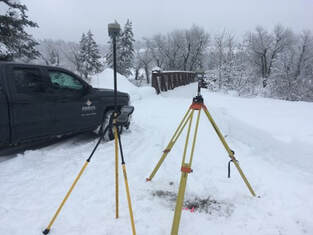
Having clear and accurate maps of existing conditions is the foundation for high-quality engineering and landscape architecture plans. When engineers have the opportunity to interact directly with the surveyors, our clients get better products. We use the latest technologies in our land and bathymetric surveying services including a Bathylogger BL200 single beam echo sounder with 0.01m + 1% depth accuracy to 100m, a  16-ft 40HP Explorer Jet Boat, Trimble R10-2 ProPoint GNSS system, and a Trimble S7 Robotic Total Station. 
​

  • Topographic land surveys
  • Bathymetric surveys
  • ALTA/NSPS Land Title surveys
  • Boundary and Corner locates
  • As-built surveys
  • Construction Staking
  • Subdivision Plats and Boundary Adjustments
  • Legal Descriptions
"I found [Harmony Design & Engineering's] work to be of high professional quality and to be very responsive and timely at all times. I would recommend them for municipal engineering projects and assistance with grant preparation."
                                             - Tom Hellen, PE, former Public Works Director/City Engineer
                                               City of Hailey, Idaho
projects
Picture
Copyright © 2009 Harmony Design, Inc. All Rights Reserved.
18 N. Main, Suite 305 | PO Box 369 | Driggs, ID 83422
208.354.1331 (tel)   


Home      Services       Projects       About        Contact